ATTRACTIONS
FJAÐRÁRGLJÚFUR
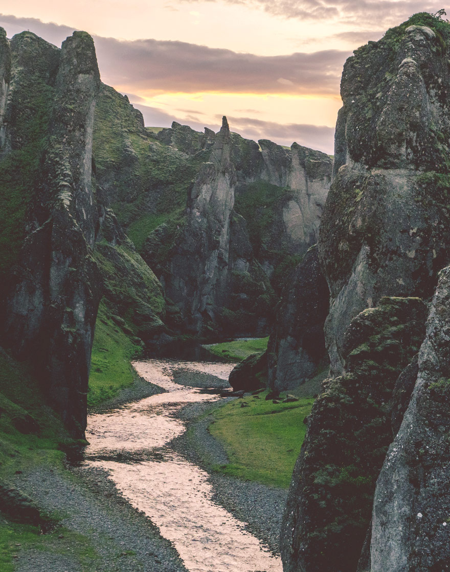
North-east of Hrífunes, on the east side of the huge lava-field of Skaftáreldahraun, lies the Fjaðrárgljúfur gorge, one of the most spectacular natural attractions in the country. It has long been a popular destination, not least since the Canadian pop idol Justin Bieber recorded a music video there which has been viewed more than 380 million times.
Fjaðrárgljúfur is about two kilometres long and 30 metres deep, and is a very impressive sight. It is believed to have been formed in a catastrophic event about 9,000 years ago. It is most likely that the river Fjaðrá, which flows from the Geirlandshraun lava-field into the river Skaftá, wore its way gradually through the tuff. Fjaðrá is now a small and innocent-looking freshwater stream, but it must have changed its character considerably since then: a raging torrent, carrying quantities of sand and mud from the glacier, must have carved out the gorge. Fjaðrárgljúfur is steep-sided, with a zig-zag course and is very narrow in places. The walls display various types of tuff, volcanic ash, breccia and lumps of more compact basalt. There is much here, besides the majesty and beauty of the gorge itself, to reward the visitor: birds, plants, water and the changing effects of light and weather make this natural wonder well worth the 25 minutes it takes to reach it from Hrífunes.
DVERGHAMRAR
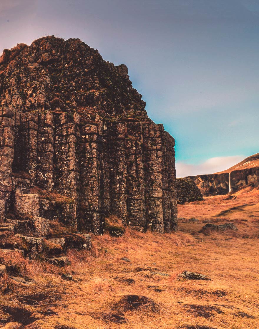
Rather further than Fjaðrárgljúfur, east of the village of Kirkjubæjarklaustur, are the rock formations of Dverghamrar (‘Dwarf Cliffs’), a beautifully-formed sequence of basalt columns not far from Hrífunes. They form a horseshoe-shaped enclosure and are thought to be ancient coastal cliffs, dating from the end of the Ice Age, from which the breakers washed the loose tuff, revealing the columnar basalt below. The columns are capped by another variety of basalt. There is a fine view from the site of the farms in Síða, which is among the most picturesque farming communities in Iceland.
The formations at Dverghamrar are well marked with a sign on the main road. This includes a drawing by Erla Stefánsdóttir, an elf enthusiast, of a dwarf, measuring 20-30 cm in height, who she claims lives in the cliffs. The existence of elves and dwarves is a recurrent element in Icelandic folklore, and formations like these were commonly believed to the homes of these invisible beings; dwarves are particularly closely associated with cliffs and rocks.
Dverghamrar are surrounded by grassy slopes. This is a pleasant place to relax, walk around and perhaps listen for sounds of singing from inside the cliffs. There is considerable variety in the columnar basalt shapes: ‘floors’ consisting of the rough polygonal column ends, regular walls and columns that lean forwards from the perpendicular. An ideal place for a picnic and perhaps a folktale or two.
REYNISFJALL & FJARA
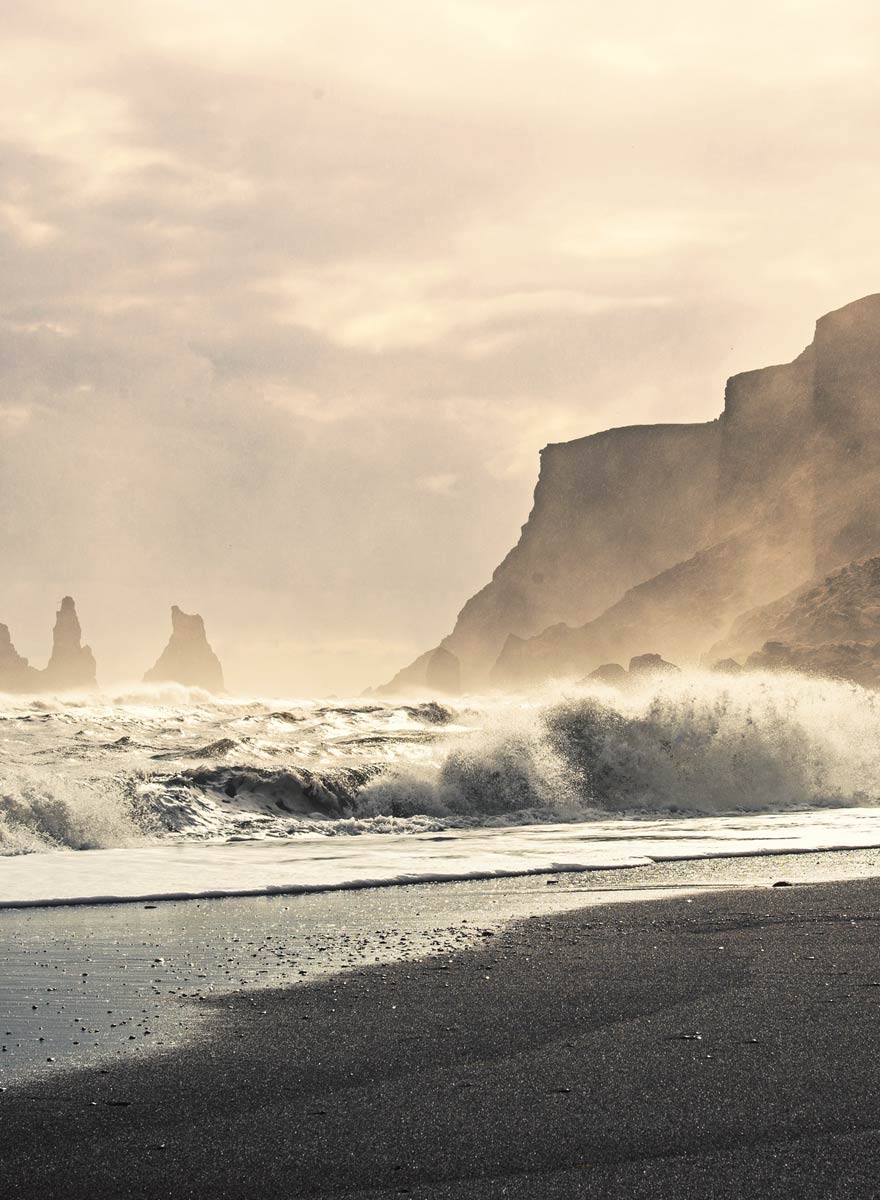
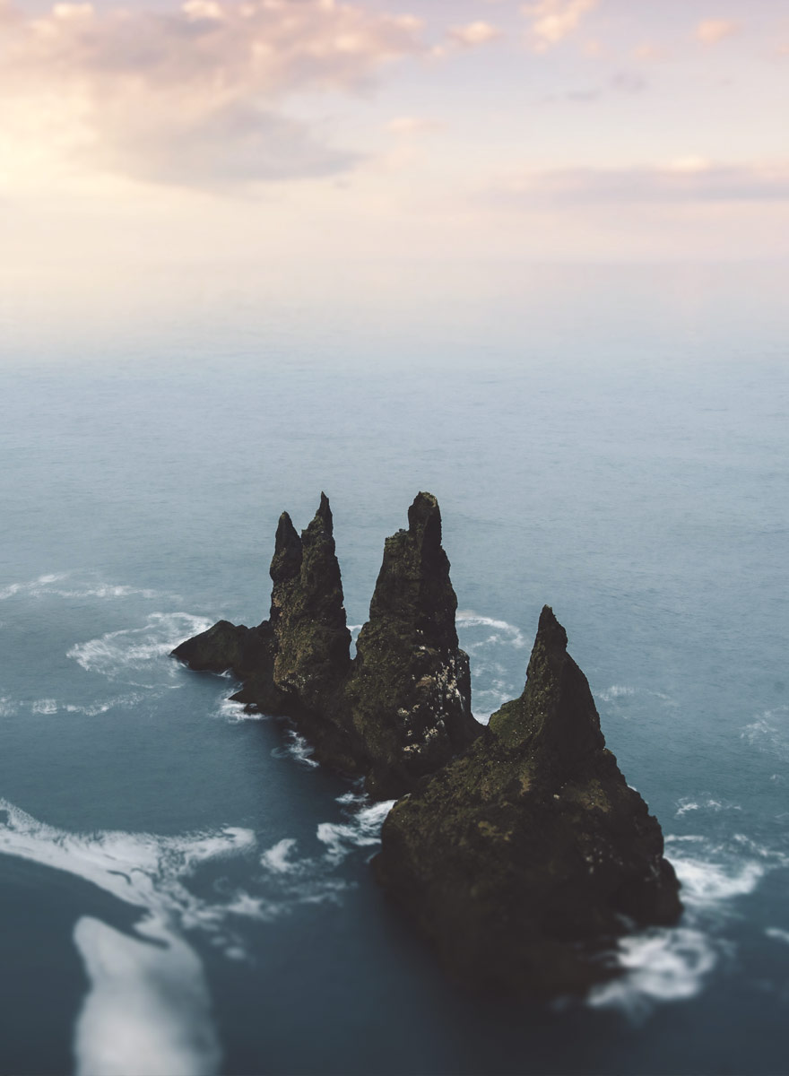
At 340 metres, the mountain Reynisfjall towers over the village of Vík í Mýrdal. It is composed of layers of tuff with basalt belts, and extends down towards the sea. In front of it, rising up out of the water, are the rock stacks of Reynisdrangar. According to a folk-tale, two trolls set out to tow a three-masted ship ashore but were turned to stone by the rays of the rising sun. There are four stacks; the highest, at 65 m, has only been climbed once.
A steep road runs up the mountain from Vík. It was made when the US Army operated a Loran station on the mountain, and is said to be the steepest stretch of road in Iceland. This may or may not be true, and all four-wheel-drive vehicles can make the ascent and come back down again. Remains of the military structures and occupancy can still be seen on the top of the mountain with various souvenirs of an age now past. Broken and disintegrating desks lie on their sides among rusting fridges, and pages from operating manuals for complex equipment blow about in the wind. It could be said that the boundary line in the Cold War ran through the mountain, as the Loran system was used by submarines to navigate in the depths of the ocean in the same way as the GPS system is used in navigation and positioning today. A walk up to the top of Reynisfjall to look at the remains and enjoy the view out over the Reynisdrangar rock stacks is a rewarding experience.
To the west of the mountain lies one of the most frequently visited sightseeing spots in the country, the beach of Reynisfjara. Here the visitor is between the open sea and a vast black-sand beach, the four rock stacks and a wall of basalt columns. For this reason, the beach, with its exposure to the elements, has a unique pull for tourists – but unfortunately the other side of the coin is that it is an extremely dangerous spot. The breakers rise in unpredictable surges and several fatal accidents have occurred in which people have lost their footing and been drowned in what seemed calm water only a few seconds before. Be careful and heed the warning signs!
ELDGJÁ
Eldgjá (‘Fire Chasm’) lies northwest of Hrífunes Park. It is an eruption fissure, formed in a huge volcanic outbreak that occurred in the year 934. As a geological feature it is unique in the country; it is neither a traditional volcano nor an eruptive crater.
The bottom layers in the walls of the chasm are of tuff and tillite, which is the dominant rock type in the area. The lava shows features of having been produced in an eruption with massive ejections that reached a great height. This gives it a range of colours that gives the chasm a special appearance.
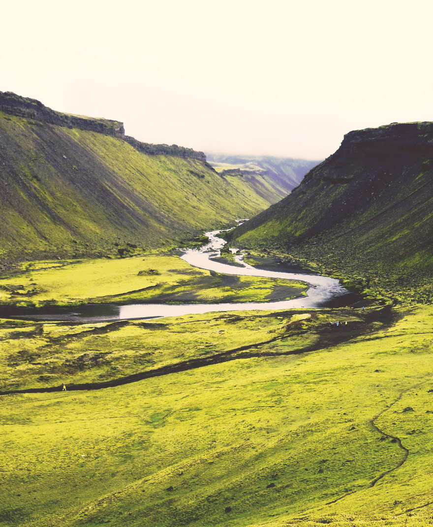
In all, Eldgjá extends over 30 km in length, the clearest features of the chasm being at the northern end, near Gjátindur, and in the south near Landmannaleið. At these points it is 300-600 m wide, with a depth of 100-150 m, and these are the most popular destinations for sightseers. From Gjátindur there is a good view over Eldgjá, to the mountains flanking the lake Langisjór, and to the Fjallabak and Síðumannaafréttir areas, including Lakagígar. The ascent of Gjátindur is a pleasant walk. From the parking-place there is a path up to the waterfall Ófærufoss and also to the eastern edge of the Eldgjá chasm.
DYRHÓLAEY
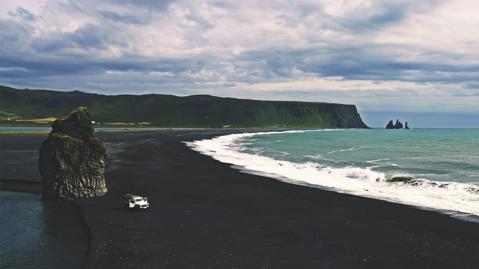
Dyrhólaey is a unique tuff stack not far from Reynisfjall. The name (translating as ‘Door Hill Island’) refers to the ‘doorway’ or hole that has opened in this long, 120-metre-high neck of rock jutting into the sea. It was long the southernmost point in Iceland since glacial rivers joined it to the mainland by their alluvial deposits during the last Ice Age. Dyrhólaey was declared a protected site in 1978 in an attempt to save the puffin colony from disruption.
The island is divided into two: Háey (‘High Island’) to the west and Lágey (‘Low Island’) to the east. Except for a small stretch on the north side, it is flanked by steep cliffs. To the west lie the beaches of Dyrhólahverfi, with the rock stack Hildidrangur.
Dyrhólaey is believed to have been formed about 100,000 years ago during a warm interglacial period in the Ice Age, originating in submarine eruption. There were probably two separate eruptions, the first emerging from an eruption fissure to the east of the island; this produced only loose tephra and the sea completely eroded the resulting island. Later, another eruption began further west with a massive explosion. Gradually the island rose above the water level and kept the volcanic channel isolated from the sea. The island was probably considerably larger than it is now, and it has been eroded by wave action and glaciation.

DYRHÓLAEY
Dyrhólaey is a unique tuff stack not far from Reynisfjall. The name (translating as ‘Door Hill Island’) refers to the ‘doorway’ or hole that has opened in this long, 120-metre-high neck of rock jutting into the sea. It was long the southernmost point in Iceland since glacial rivers joined it to the mainland by their alluvial deposits during the last Ice Age. Dyrhólaey was declared a protected site in 1978 in an attempt to save the puffin colony from disruption.
The island is divided into two: Háey (‘High Island’) to the west and Lágey (‘Low Island’) to the east. Except for a small stretch on the north side, it is flanked by steep cliffs. To the west lie the beaches of Dyrhólahverfi, with the rock stack Hildidrangur.
Dyrhólaey is believed to have been formed about 100,000 years ago during a warm interglacial period in the Ice Age, originating in submarine eruption. There were probably two separate eruptions, the first emerging from an eruption fissure to the east of the island; this produced only loose tephra and the sea completely eroded the resulting island. Later, another eruption began further west with a massive explosion. Gradually the island rose above the water level and kept the volcanic channel isolated from the sea. The island was probably considerably larger than it is now, and it has been eroded by wave action and glaciation.
LANDMANNALAUGAR
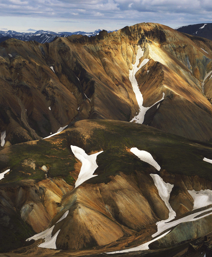
Among both domestic and foreign tourists, Landmannalaugar is now the most popular place in the interior of Iceland. It is a place of spectacular contrasts in the landscape with an unusual range of colours, and once seen it is not quickly forgotten. A number of interesting hiking paths have been staked out and several tour operators run organised visits and activities; there is also a well-appointed campsite with toilet facilities. In the course of a day, the visitor can see lava and tuff mountains, deep valleys and lava-fields, and relax in a natural hot pool in the evening.
The hot pool in Landmannalaugar is fed by geothermal springs from the edge of the Laugahraun lava-field, the water mixing with cold sources from under the lava. A small retaining wall creates an attractive pool with a pleasant temperature that can take several dozen people at once. The water is generally slightly warmer in winter than in summer; as a result, the vegetation is lusher and more varied than might be expected at the altitude of 600 m. Varieties of tundra vegetation, clover and Arctic plants used in traditional medicine can be found close to the pool and elsewhere in the area.
ÞÓRSMÖRK
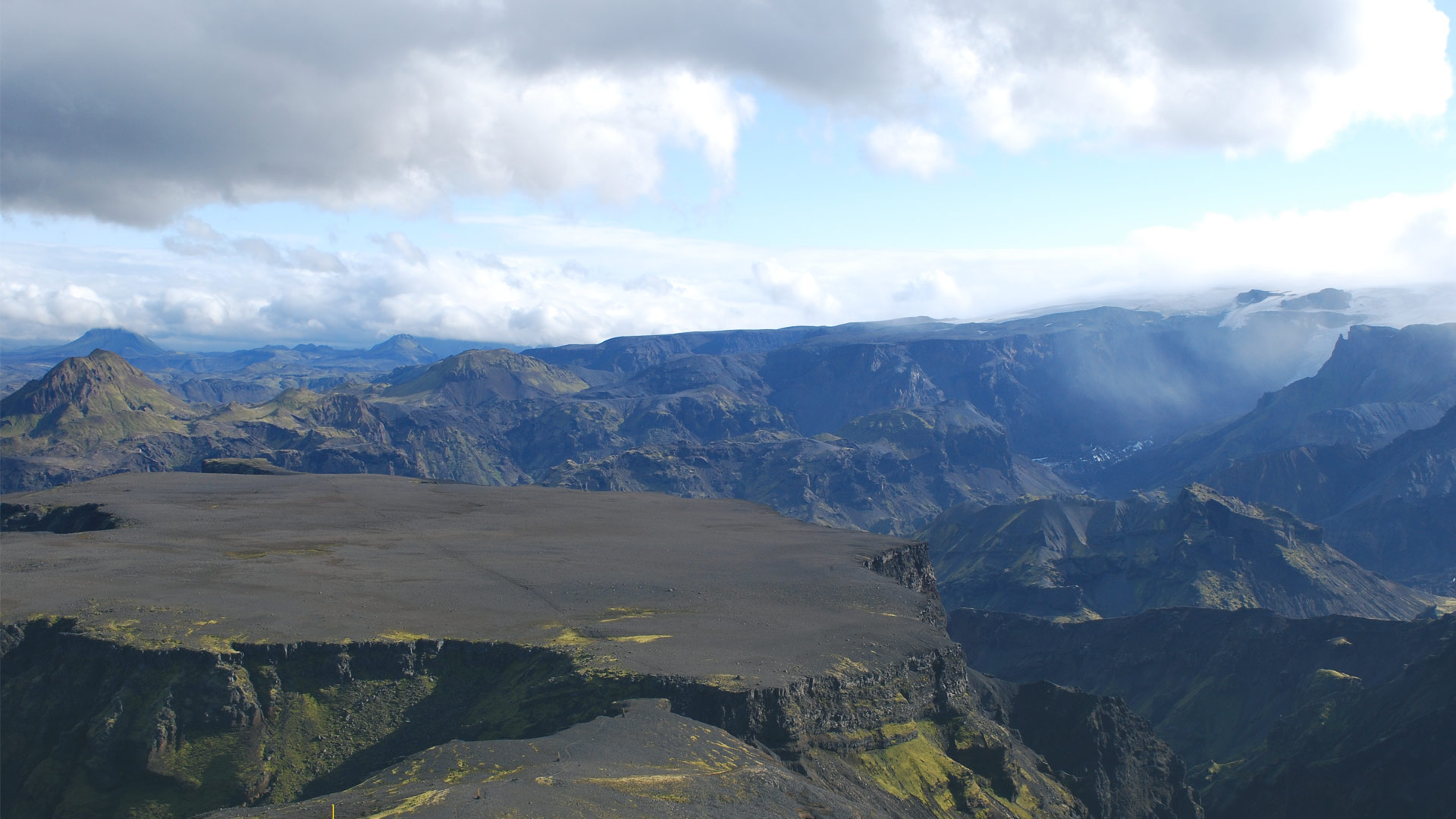
Þórsmörk (‘Thor’s Forest’) is a natural wonder lying in the embrace of mountains and glaciers, north of Eyjafjallajökull and west of Mýrdalsjökull. The landscape here is of tuff that was piled up in the Ice Age, later to be planed and carved by glaciers and rivers to produce a wide variety of forms. At first sight it seems a rough and harsh landscape with thundering glacial rivers, rugged mountains, gorges, isolated cliffs and glacial moraines, but on closer acquaintanceship it reveals a surprisingly lush vegetation cover. Springs and cascades stream down the near-vertical walls of mossy gorges and cliffs; woods with rich undergrowth and grassy expanses lie in the shelter of valleys and cliff fronts. Naturally, all this makes an ideal habitat for numerous bird species in all seasons.
The main reason for the lush vegetation of Þórsmörk is its natural isolation: the rivers, glaciers and precipitous mountains have prevented livestock from entering the area. In the 19th century, farmers in the Fljótshlíð area used to drive their flocks here to graze and also cut wood from the natural forest. The result was that the vegetation was in poor shape at the beginning of the 20th century. After the eruption of Katla in 1918 it was decided to put a stop to further grazing and the site was put under the supervision of the State Forestry Service.
Þórsmörk is one of the most popular recreational resorts in Iceland, visited by many people at all times of the year. It is the ideal place to ‘get away from it all’ and enjoy a totally different environment that is packed with variety. There are many marked walks and hiking trails in Þórsmörk, e.g. to Eyjafjallajökull, the ‘Laugavegur’ trail to Landmannalaugar and the route south across Fimmvörðuháls to Skógar. Shorter walks within the boundaries of Þórsmörk include those to Litlaendi, Stóraendi and Valahnúkur. Þórsmörk enjoys something of a micro-climate with warmer and drier weather than in adjacent areas, as it is protected to some extent from the visitation of rain clouds by the surrounding high mountains.

ÞÓRSMÖRK
Þórsmörk (‘Thor’s Forest’) is a natural wonder lying in the embrace of mountains and glaciers, north of Eyjafjallajökull and west of Mýrdalsjökull. The landscape here is of tuff that was piled up in the Ice Age, later to be planed and carved by glaciers and rivers to produce a wide variety of forms. At first sight it seems a rough and harsh landscape with thundering glacial rivers, rugged mountains, gorges, isolated cliffs and glacial moraines, but on closer acquaintanceship it reveals a surprisingly lush vegetation cover. Springs and cascades stream down the near-vertical walls of mossy gorges and cliffs; woods with rich undergrowth and grassy expanses lie in the shelter of valleys and cliff fronts. Naturally, all this makes an ideal habitat for numerous bird species in all seasons.
The main reason for the lush vegetation of Þórsmörk is its natural isolation: the rivers, glaciers and precipitous mountains have prevented livestock from entering the area. In the 19th century, farmers in the Fljótshlíð area used to drive their flocks here to graze and also cut wood from the natural forest. The result was that the vegetation was in poor shape at the beginning of the 20th century. After the eruption of Katla in 1918 it was decided to put a stop to further grazing and the site was put under the supervision of the State Forestry Service.
Þórsmörk is one of the most popular recreational resorts in Iceland, visited by many people at all times of the year. It is the ideal place to ‘get away from it all’ and enjoy a totally different environment that is packed with variety. There are many marked walks and hiking trails in Þórsmörk, e.g. to Eyjafjallajökull, the ‘Laugavegur’ trail to Landmannalaugar and the route south across Fimmvörðuháls to Skógar. Shorter walks within the boundaries of Þórsmörk include those to Litlaendi, Stóraendi and Valahnúkur. Þórsmörk enjoys something of a micro-climate with warmer and drier weather than in adjacent areas, as it is protected to some extent from the visitation of rain clouds by the surrounding high mountains.
JÖKULSÁRLÓN
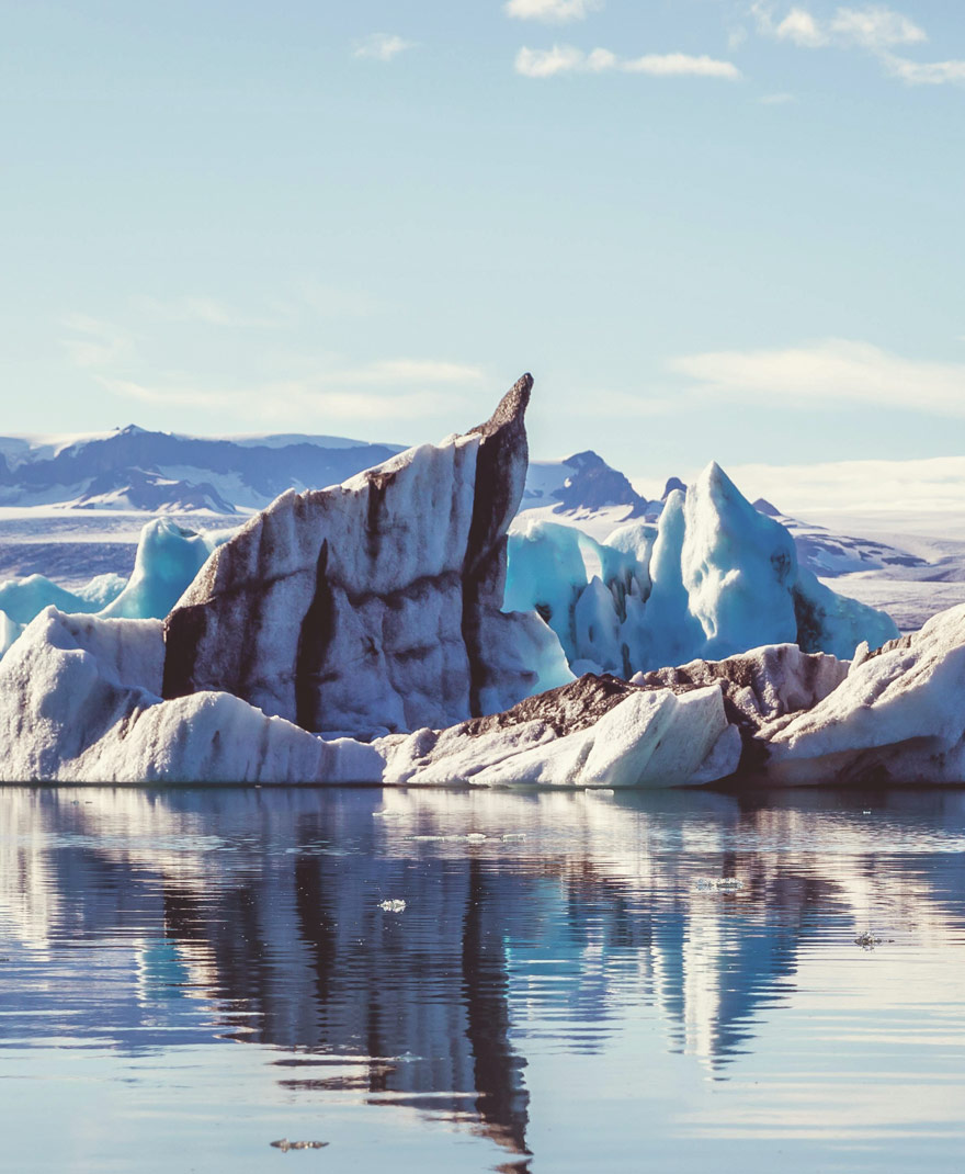
This lagoon, 250 km east of Hrífunes on the main road is one of the most popular tourist attractions in Iceland. The ever-changing display of icebergs, sunshine and shadow presents a challenge to the photographer and the landscape artist; you can also take a boat trip among the ice floes on the lagoon. The lagoon has been used in several films, some of them world famous. James Bond and Angelina Jolie are probably the brightest stars to have shone on the sand and water with the ice in the background.
For those who prefer a less crowded experience of a glacial lagoon, the one on Fjallsá, near Jökulsárlón, offers much the same experience, with majestic icebergs floating on a calm lake and a view of the glacier as it descends towards the sea. Those who visit Fjallsárlón early in the day in calm weather should be able to hear the creaking of the glacier as it moves a few millimetres each day.
Services at the lagoon have been expanded recently. At present there is a café offering light refreshments while further developments are planned in the future.
LAKAGÍGAR
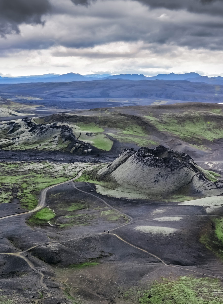
Lakagígar is a gigantic chain of volcanic craters punctuating a 25 km long fissure running southwest from Vatnajökull. The fissure extends from the edge of the valley glacier Síðujökull to Úlfarsdalur. Near the middle of its range it cuts through the tuff mountain Laki, which gives the craters their collective name (‘Laki Craters’).
Many of the craters merge into each other, and inside some of them are still further small individual craters, so it is difficult to state a definite number for the whole series. The eruption of Lakagígar in 1783 was, for the Icelandic nation, the greatest single catastrophe that has occurred. It began early in the summer and ended only in the February of the following year. As a result of the eruption, 75% of the sheep, 50% of the horses and 40% of cattle in Iceland died. This resulted in widespread famine and death: about 10,000 people, one-fifth of the population, died over the course of two years.
Poisonous gases and an aerosol haze in the atmosphere were the main causes of these deaths and losses. The haze was caused by volcanic gases released from the craters and the lava flow. It affected the weather, blocking the heat of the sun, resulting in lower temperatures and also acid rain. Grass became contaminated by chemicals deposited by the ash-fall and the poisonous rain, and as farm animals grazed they absorbed toxins, including fluorine, that stimulated unnatural bone growth. Their teeth and bones developed at abnormal rates and the animals were soon unable to eat or walk. Many of them died either as a result of these toxins or else from starvation.
These craters, formed by an eruption that almost wiped the Icelandic nation out, remain today as a fascinating geological feature with a unique history. Now green with moss, the craters lie across an area of black sand, and it is quite an experience to climb up to the highest point and try to imagine what they must have looked like when the lava flow was in full swing. From the top there is an impressive view to the river Skaftá and the Fögrufjöll mountains in the north. Just beyond them lies the lake Langisjór. Further towards the right looms the Vatnajökull glacier, while the lakes Lambavatn and Kambsvatn lie straight ahead.
VÍK Í MÝRDAL
Mýrdalur is an area of contrasts and magnificent landscapes. It has a lot of precipitation which waters the brilliant green grass in the steep mountainsides, while higher up, on the Mýrdalsjökull glacier, it falls as snow and maintains the ice-cap. East and west of the Mýrdalur valley lie barren sands that were deposited in massive floods released from the Sólheimajökull and Kötlujökull glaciers. During the summer, Mýrdalur, with its blaze of green grass, stands out in vivid contrast to these stretches of sand, particularly the stark blackness of Mýrdalssandur. Nowhere else in Iceland is the grass greener, and at first sight the whole area seems to be under a thick coating of vegetation: even the cliff sides of the tuff mountains, the rugged gorges and the naked peaks of the highland interior seem to take on a velvety appearance with the approach of summer.
The village of Vík í Mýrdal seems tiny beneath Reynisfjall, but it plays an immensely important role in the service network of Southern Iceland. It is the third most-visited tourist destination in the country, with nearly one million visitors every year.
In past centuries fishermen’s row-boats used to set out from the beach below the village, but fishing no longer plays any part in the local economy. It was difficult due to the lack of any natural harbour and the violence of the breakers. The village also used to play a role in providing services for the local farmers, and to a trickle of tourists. Now this is all changed: Vík is the largest service centre in the south of the country, with food shops, hotels, a wine and spirit retail outlet, a post office, bank, gymnasium and a swimming pool.
Vík provides overnight accommodation for more than a thousand people, and many restaurants, no two of them alike, have opened up to meet their needs. The main attractions of the village include walks on the rewarding hiking paths, microlite flying, bird-watching and day-trips further afield with tour operators; these include glacier climbs on Sólheimajökull, snowmobile trips on the Mýrdalsjökull glacier and other sightseeing trips in 4×4 vehicles.
KIRKJUBÆJARKLAUSTUR
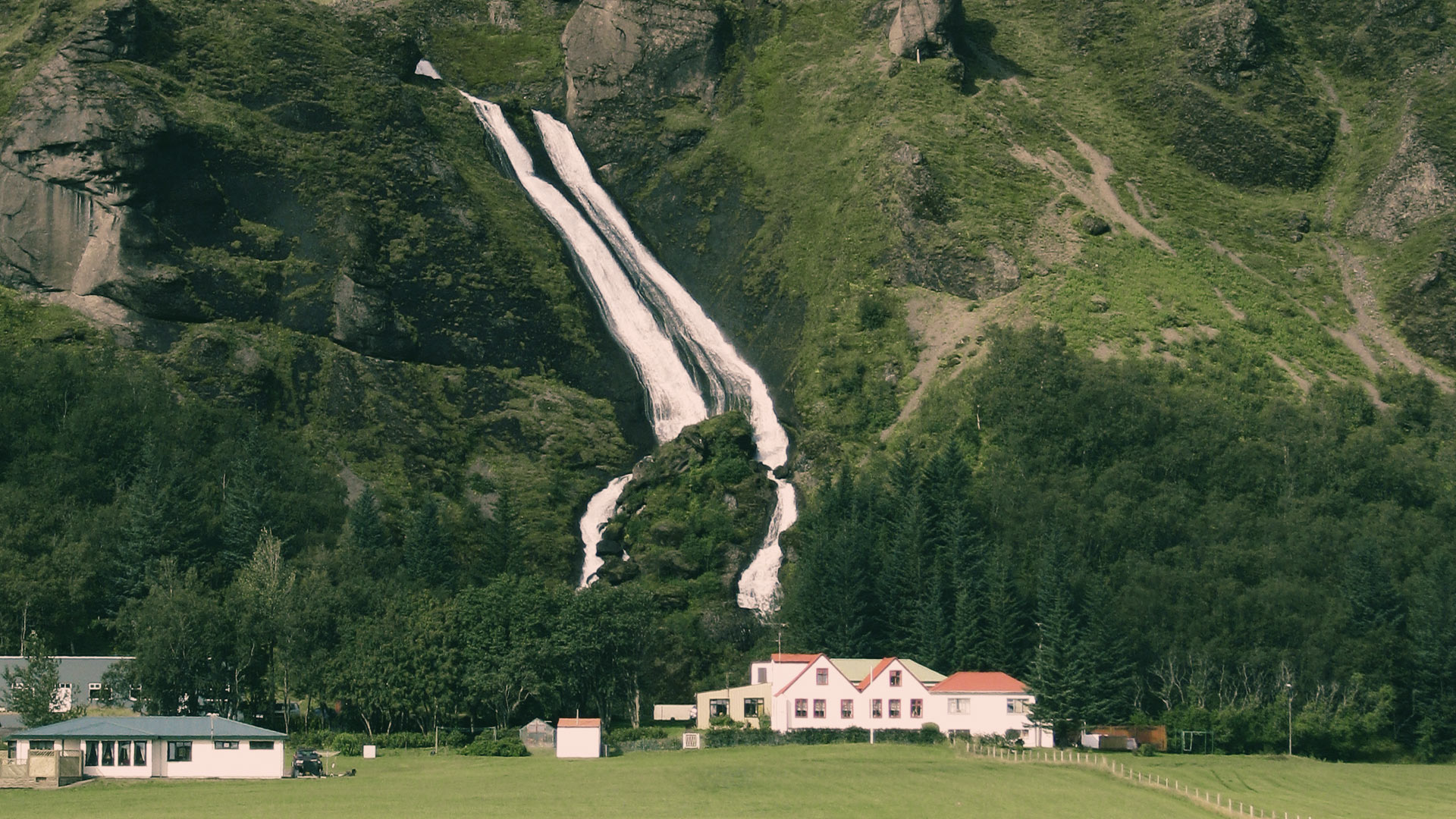
Nestling under the mountains, the small village of Kirkjubæjarklaustur, with its abundant tree growth, has a rich history and is the centre of services for a large part of southern Iceland. Facilities in the village include food shops, a wine and spirit retail outlet, a pharmacy, health clinic, car repair workshop, hairdressing salon, a craft shop, exhibition gallery and restaurants. It also has a fine gymnasium, swimming pool and sports field.
In Icelandic terms, Kirkjubæjarklaustur enjoys an unusually comfortable mild climate, with mild winters and warm, sunny summers which attract both domestic and foreign tourists. Agriculture, tourism and other services form the main occupations; as in many other parts of the country, tourism has expanded immensely in recent years, and the village is in a key position midway between Vík í Mýrdal and Jökulsárlón.
The village has a long and interesting history. It is believed that Irish monks were living on the site when the Norse settlers arrive in the late 9th century. In 1186 a nunnery was founded on the farm Kirkjubær (‘Church Farm’); hence the rather unwieldy name Kirkjubæjarklaustur, which translates as ‘the Nunnery at Church Farm’. The nunnery was abolished in 1554 following the Reformation.
There are several natural attractions close to Kirkjubæjarklaustur. These include the waterfall Systrafoss (‘Sisters’ Waterfall’) and the isolated mound Systrastapi (‘Sisters’ Mound’), both which names allude to the proximity of the nunnery in the past. According to a folk tradition, the graves of two of the nuns are on the top of the mound, where they were burned at the stake for breaches of the nunnery’s rules. One is supposed to have made a pact with the Devil, taken the communion host past the door of the privy and had sexual relations with men; the other is supposed to have spoken disrespectfully about the Pope. The waterfall Systrafoss, above the village, is fed by water from the Systravatn lake on the top of the hill. The waterfall is supposed to owe its name to two nuns who died in an attempt to retrieve a golden comb from the lake. One tried to wade out into the lake; the other rode into it on horseback and disappeared.

KIRKJUBÆJARKLAUSTUR
Nestling under the mountains, the small village of Kirkjubæjarklaustur, with its abundant tree growth, has a rich history and is the centre of services for a large part of southern Iceland. Facilities in the village include food shops, a wine and spirit retail outlet, a pharmacy, health clinic, car repair workshop, hairdressing salon, a craft shop, exhibition gallery and restaurants. It also has a fine gymnasium, swimming pool and sports field.
In Icelandic terms, Kirkjubæjarklaustur enjoys an unusually comfortable mild climate, with mild winters and warm, sunny summers which attract both domestic and foreign tourists. Agriculture, tourism and other services form the main occupations; as in many other parts of the country, tourism has expanded immensely in recent years, and the village is in a key position midway between Vík í Mýrdal and Jökulsárlón.
The village has a long and interesting history. It is believed that Irish monks were living on the site when the Norse settlers arrive in the late 9th century. In 1186 a nunnery was founded on the farm Kirkjubær (‘Church Farm’); hence the rather unwieldy name Kirkjubæjarklaustur, which translates as ‘the Nunnery at Church Farm’. The nunnery was abolished in 1554 following the Reformation.
There are several natural attractions close to Kirkjubæjarklaustur. These include the waterfall Systrafoss (‘Sisters’ Waterfall’) and the isolated mound Systrastapi (‘Sisters’ Mound’), both which names allude to the proximity of the nunnery in the past. According to a folk tradition, the graves of two of the nuns are on the top of the mound, where they were burned at the stake for breaches of the nunnery’s rules. One is supposed to have made a pact with the Devil, taken the communion host past the door of the privy and had sexual relations with men; the other is supposed to have spoken disrespectfully about the Pope. The waterfall Systrafoss, above the village, is fed by water from the Systravatn lake on the top of the hill. The waterfall is supposed to owe its name to two nuns who died in an attempt to retrieve a golden comb from the lake. One tried to wade out into the lake; the other rode into it on horseback and disappeared.


